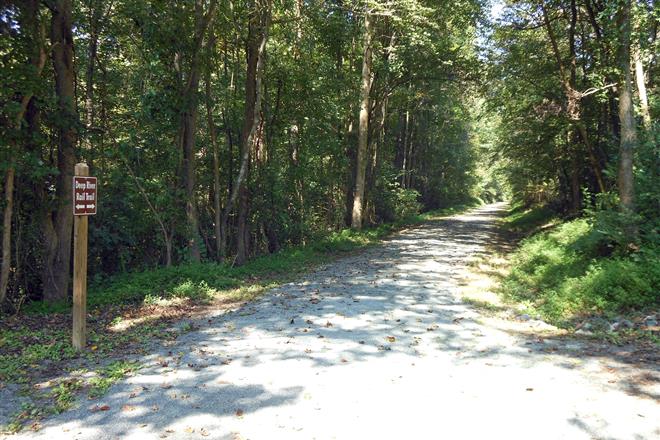
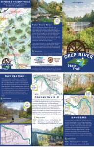
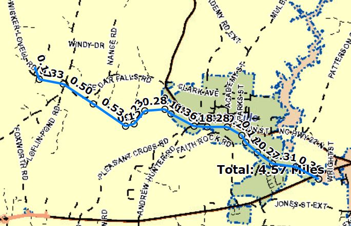
The Textile Trail Greenway along Deep River in the Town of Franklinville is a pedestrian hiking and biking trail following the abandoned Cape Fear and Yadkin Valley Railway corridor from US 64 to Cedar Falls. Also known as the Deep River Rail Trail, it is a portion of the much larger of the Deep River State Trail established in 2007 by Senate Bill 1431 to protect the natural resources and enhance the recreational potential of the river. The nucleus of the park were two tracts in Chatham County totaling 944 acres which were originally preserved by the Triangle Land Conservancy, and the conceptual plan envisions both a greenway and blueway trail developed with launch points, camping locations and points of interest for canoeists, paddle boarders and kayakers.
For over a century the textile mill corporations maintained properties on both the North and South sides of Deep River in Franklinville as private park land. The South side of the river around Faith Rock was left in a largely natural state, and as early as deeds in the 1850s was referred to as “Coffin’s Reserve,” after the founder of the Town, Elisha Coffin. A footbridge near the Upper Mill first crossed the river to allow access to Faith Rock in the late 19th century. In 1923 David and John Clark, sons of N.C. Supreme Court Chief Justice Walter Clark purchased the mill companies, and a letter exists from their father advising them to hire Frederick Law Olmsted Jr. to devise a landscape plan for the riverside area (This was never done).
When Randolph Mills entered bankruptcy in 1978, the Town of Franklinville owned no public park land and had no outdoor maintenance staff. Its first acquisition was the little league baseball field across from the Fire Department, established by John W. Clark in July 1926[1] and purchased by the Town in August 1985.[2] The 12.89-acre riverside park on the North side of the River was sold by the court to William and Char Lee,[3] who sold it to the Town in 1989.[4]
The park tract was bisected the River Road, the half mile-long street connecting the Upper and Lower mills. Parallel to the road was the Cape Fear and Yadkin Railway, opened up to Franklinville in June 1890. Known as the “Factory Branch,” as it branched off the Mt. Airy to Fayetteville main line, at Julian, coming South along NC22 to Millboro, thence following Deep River to Franklinville and Ramseur, where it terminated at a turntable. In Franklinville its passenger and freight depot was located at the foot of Depot Street, just west of the Methodist Church. In 1984 Southern Railway, then the owners, petitioned the state and the Interstate Commerce Commission to abandon the route; the petition was granted in 1986 and the tracks and trestles were removed in 1987.
The Deep River Textile Trail was proposed as part of the Deep River Industrial Heritage Corridor in 1998 to be a regional greenway which extending from Oakdale Mill in Jamestown, Guilford County, to the ruined mill in High Falls in Moore County. It was to highlight the working heritage of the small communities which line the river, preserving and renovating neglected waterfront properties and providing convenient public access points to Deep River, drawing attention to the hidden historic assets and natural resources of the region, rebuilding local pride and triggering economic development. A bill passed the state senate in 2000, but failed to pass the House.
The 4.5 mile CFYVRR corridor lying within, east and west of the Town of Franklinville would have formed the core of the Textile Trail, and were used as the basis of the original Greenway Master Plan, written in June 2002.[5] The first elements of the greenway were protected by the Town with the purchase of three tracts that included 0.3 mile of the former rail right-of-way that runs from Sandy Creek East to the decommissioned NC Wildlife Commission Boat Ramp. Using grant funds from the state trails program, the project created a gravel and hard-surfaced pedestrian hiking and biking trail along the abandoned railroad corridor from the Wastewater Treatment Plant at Rising Sun Way east to Sandy Creek. Right-of-way was deeded to the Town in 2012.
While deeded easement or fee simple ownership has protected some two and a half miles of railroad right-of-way, only one mile is presently open to the public. In part this is due to the difficulty of re-establishing stream crossings at the sites of the demolished trestles over Gabriel’s Creek in Ramseur; Sandy Creek, Walnut Creek and Bush Creek in Franklinville; and White’s Memorial Road in Cedar Falls.
[1] Deed Book 223, Page 481, recorded 24 July 1926. [2] 2.6 acres in DB 1168, Pg 209, rec. 2 Aug 1985 and 0.41 acres in DB 1210, Pg 1304, rec. 6 Nov. 1987. [3] DB 1162, Pg 1233, rec. 12 April 1985 [4] DB 1239, Pg 496, rec. May 1989. [5] 2.6 acres in DB1690, Pg. 706 on 13 Dec. 2000; 2.2 acres from the State of NC in DB 1702, Pg. 1164 on 7 March 2001; 3.98 acres at DB 1720, Pg. 1221 on 12 July 2001


0 Comments